
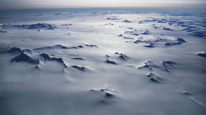
Some 34 million years ago, when Earth was significantly warmer than it is today, Antarctica froze over. It would take another 25 million years for ice to cover the Arctic, and the question of how the South Pole got its head start has puzzled scientists for decades.
Experts have long attributed Antarctica’s glaciation to global cooling driven by declining levels of carbon dioxide (CO2) in the atmosphere, but therein lie two problems. First, the ice sheets somehow began to form when the climate was still relatively mild. And second, if global cooling was the sole culprit, the Arctic would have frozen over around the same time.
This conundrum indicates that another factor must have jumpstarted the formation of Antarctica’s ice sheets, and to get to the bottom of it, a team of researchers dove deep into Earth’s geological history. Their findings, published Thursday in the journal Science, suggest that regional topographical uplift caused by continental breakup during the Jurassic period provided an elevation boost that allowed snow and ice to accumulate.
“We tend to think of dropping CO2 as the whole story, and it does matter enormously, but it doesn’t act alone: elevation and latitude are just as critical in determining whether an ice sheet can take hold and stabilize,” lead author Thomas Gernon, a professor of Earth science at the University of Southampton, told Gizmodo in an email.
Where land rises, ice forms
Roughly 170 million years ago, Antarctica and Africa were joined together as part of the supercontinent Gondwana. When they split, the rupture sent Antarctica drifting toward the South Pole and set off a chain of events deep beneath Earth’s surface, Gernon explains in an article for The Conversation.
His team’s previous research on landscape evolution in Africa revealed that continental breakup triggers deep mantle processes that reshape topography over tens of millions of years. “Africa and Antarctica were joined until they broke apart in the Jurassic, so we reasoned that the same mantle processes we’d inferred in Africa might also have shaped the land now trapped below thick ice in Antarctica,” Gernon said.
When continents break apart, molten material from Earth’s mantle rises up beneath them, cools, and then sinks. Gernon and his colleagues call these lava lamp-like disturbances “mantle waves.” As the waves ripple through molten rock, traveling hundreds of miles beneath the surface, they can generate pules of uplifted land far from the rift zone where the continent originally broke.
For this new study, Gernon’s team used computer models to simulate the effect these waves could have had on East Antarctica, home to the largest ice sheet in the world. The results showed that mantle waves gradually lifted this part of the continent to higher elevations, creating a mile-high (2-kilometer-high) cliff near the coast and an elevated plateau extending about 1,200 miles (2,000 km) inland. The wave of uplift then continued farther inland, reaching the Gamburtsev mountains roughly 100 million years later.
According to Gernon, air temperature drops by roughly 1.8 degrees Fahrenheit (1 degree Celsius) for every 328 feet (100 meters) of elevation gained. His team’s calculations suggest that by 45 million years ago, East Antarctica’s landscape had risen enough for mountain glaciers to form.
The more ice and snow accumulated, the more sunlight the continent reflected back into space, cooling the surrounding region. And as the air over Antarctica cooled, it held less water vapor, causing temperatures to decline further. These feedbacks allowed the mountain glaciers to expand across the continent and become the ice sheet we see today.
A cautionary tale
While these findings are based on modeling, there is real geological evidence to support them, according to Gernon. “In the Dronning Maud Land and Transantarctic Mountains, where rock is exposed at the peaks, we can date the uplift directly using thermochronology, a method that reads the cooling and heating history locked in minerals, much like a geological flight recorder,” he said. That record shows evidence for uplift happening around the same time that his team’s model predicts.
As for the Gamburtsev mountains, they are buried under 2 miles (3 km) of ice, so researchers can’t sample them directly. “But we can still read the landscape using radar echosounder surveys,” Gernon explained. “The peaks are alpine-like, the signature of mountains that were actively uplifting and being carved by river erosion right up until the ice buried and preserved them.”
This study shows that the geological processes that uplift land and create mountains play a crucial role in ice sheet formation, but it also offers a cautionary tale for our warming world, according to Gernon. Ice sheets melt much faster than they grow, and as they melt, they significantly erode the landscape beneath them. “That means once an ice sheet collapses, it can’t simply regrow the way it formed the first time,” he explained. “You cannot shortcut geological time and the role it plays in creating the perfect blend of conditions to build an ice sheet.”
Read the full article here