
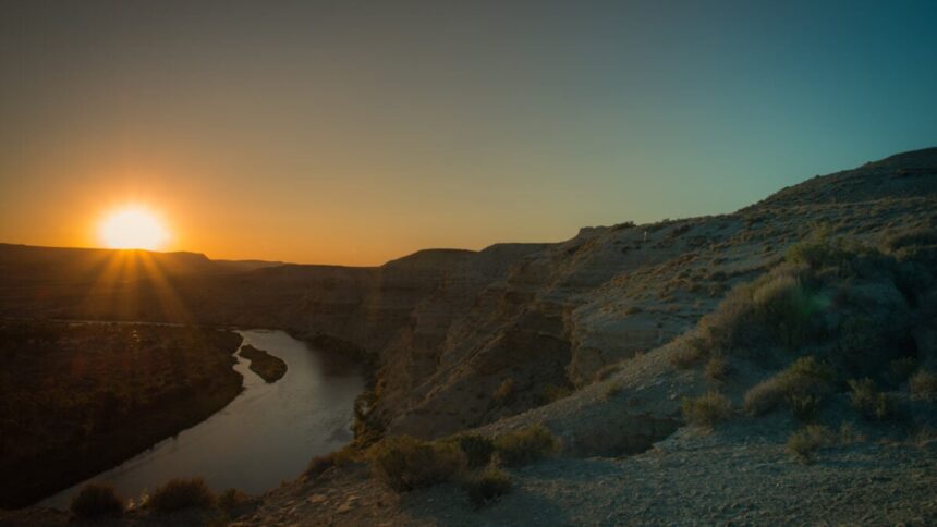
The Western United States’ Green River seems to have taken the path of most resistance to reach the Colorado River. New research, however, reveals that it may have had help from a hidden phenomenon.
The Green River—the Colorado River’s largest tributary—represents an enduring geological mystery. How did it carve through the Uinta Mountains in Utah instead of going around them? At one point in its history, the Green River even appears to have flowed uphill, climbing into the rising Uinta Mountains rather than being diverted around them. This defiance of basic topographic logic—not to mention the laws of physics—has stumped geologists for years.
If you’re thinking that maybe the river got there first, that’s not the answer; the Green River’s route is not even eight million years old, while the mountains are 50 million years old. Researchers think they’ve got the answer—a geological dynamic that might be behind other mysteries, too.
“For about 150 years now, geologists have debated over exactly how the rivers merged, which is a particularly challenging question for a tectonically inactive area where major geological events are rarer,” Adam Smith, a researcher at the School of Geographical & Earth Sciences at the University of Glasgow, said in a university statement. “We think that we’ve gathered enough evidence to show that lithospheric drip, which is still a relatively new concept in geology, is responsible for pulling the land down enough to enable the rivers to link and merge.”
Dripping drops
Dense material can accumulate at the bottom of the crust, Earth’s most superficial layer. When this accumulation grows sufficiently heavy, it drips—hence the name, “lithospheric drips”—into the mantle, the layer beneath the crust. The phenomenon can tug down mountains, causing them to sink, until the “drop” effectively “drips” and they can return to normal again. This recovery creates a characteristic bullseye shape in the topography.
Smith is the lead author of a study published today in the Journal of Geophysical Research: Earth Surface, in which he and his colleagues employed seismic imaging and data modeling. Seismic imaging allows researchers to understand Earth’s underground composition, and earlier seismic imaging studies revealed an anomaly—probably the detached drip—between 31 and 62 miles wide (50 and 100 kilometers) at a depth of around 124 miles (200 km). Its approximate depth and computed dripping speed suggest that it separated sometime between two and five million years ago.
This aligns with preexisting estimates of when the river probably carved through the Uinta Mountains—creating a canyon that today is 2,297 feet (700 meters) deep—and joined the Colorado system. In other words, the Green River was probably able to sculpt its modern-day route through the mountains when they were lowered by lithospheric dripping.
“The merging of the Green and Colorado Rivers millions of years ago altered the continental divide of North America,” Smith explained. “It created the line that separates the rivers that flow into the Pacific from those that flow into the Atlantic, and created new habitat boundaries for wildlife that influenced their evolution. It’s an enormously significant area of the continent.”
To be clear, the river never actually flowed uphill. As the new paper argues, lithospheric dripping temporarily pulled the mountains downward, allowing the river to continue flowing downhill along its path. To geologists looking at it today, this gives the appearance of the river flowing uphill. In reality, the river carved its path while the land was temporarily lowered, and the mountains later rebounded and rose around an already-established river canyon.
Missing material
The team found and measured the mountains’ encircling bullseye shape, unveiled by computer modeling. Furthermore, they discovered that the crust under the Uinta Mountains is significantly narrower than what researchers would anticipate for its elevation, further suggesting that a dense part of the lower crust dripped off. The increase in elevation they think this dripped material caused aligns with the uplift the river networks had led them to deduce.
“The evidence we’ve collected strongly contradicts the idea that the river predated the mountains, or that sediment deposits might have built up enough for the river to overtop the range, or that erosion from the south of the mountains captured the Green River,” Smith concluded.
To which he added: “We hope that this paper will help resolve a longstanding debate about one of North America’s most significant river systems, and help build the growing body of evidence that lithospheric drips may be the hidden answer to more tectonic mysteries than we’ve previously realised.”
Read the full article here